
An ever-changing array of images from different eras and geographies of Kansas City’s past. More slides added, more slideshows always in the works – come back often!
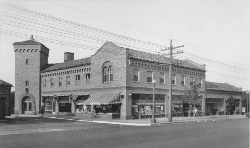
Brookside Shops
62nd Terrace to Meyer Blvd; Main Street to Wornall Road
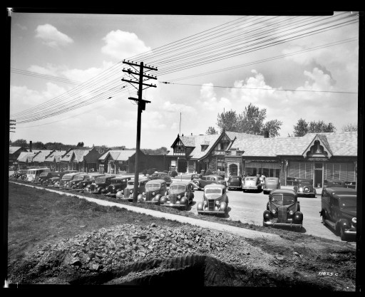
North side, 63rd Street, b/w Main and Brookside Plaza. 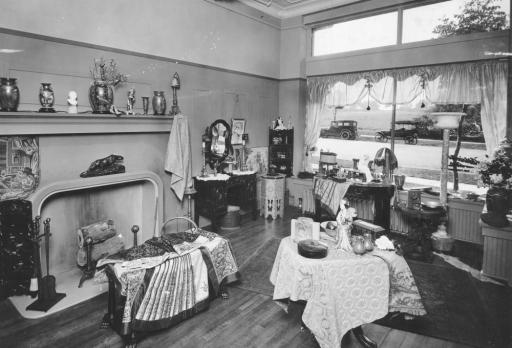
Marie Antoinette Gift Shop, 1920, Brookside Building 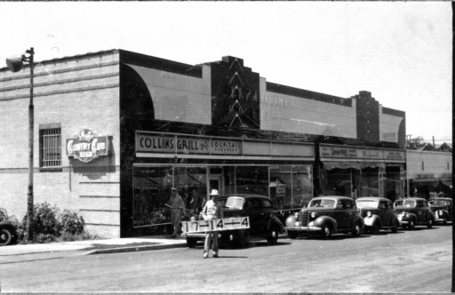
Collins Grill and Cocktail, west side Brookside Plaza, just north of Meyer. 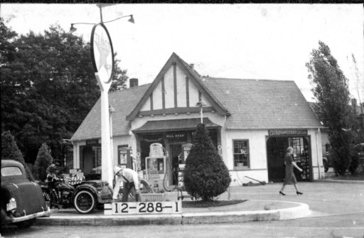
1940, Texaco Station, south west corner of 62nd Terr., Brookside Plaza. 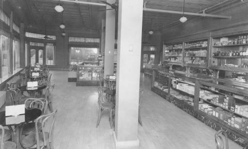
Brookside Pharmacy, 1920, Brookside Bldg. at 63rd and Brookside Blvd. 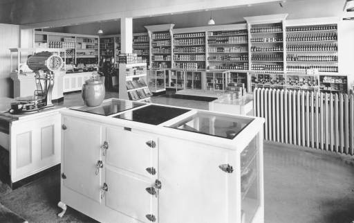
Albert Johnson grocery, 1920, Brookside Bldg, 63rd and Brookside Blvd. 
Albert Johnson grocery/meat shop, 1920, Brookside Building. 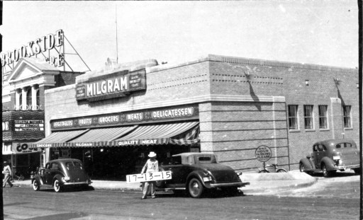
Milgram’s, 1940, east side, south end of Brookside Plaza.
Brookside Area
Neighborhoods and Institutions between 57th and 63rd Street, Troost Avenue to State Line Road
J.C. Nichols development, circa 1928, SE corner of 63rd and Troost 
Ward Parkway, looking north at 59th, looking north west 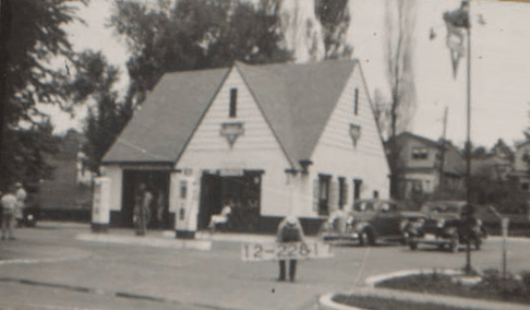
Conoco station on NE corner of 63rd Street and Cherry, 1940. 
Circa 1920, Meyer Circle Fountain in original form. Looking south. 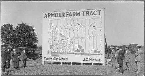
Nichols Co. reveals development plan for Armour Hills neighborhood 
Early Fairway residential development 
Mirror Pool in Ward Parkway median, at 62nd Street, looking north
Country Club District Commercial
Nichols Company commercial areas exclusive of the Plaza and Brookside
Colonial Shops looking NW on 55th b/w Oak and Brookside Blvd., circa 1910 
Colonial Shops on 55th Street, looking NE, circa 1930s 
Crestwood Shops on 55th Street b/w Brookside Blvd. and Oak, circa 1925 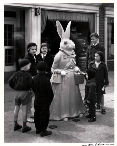
Easter Bunny in front of Crestwood Shops, 1936 
Celebration of Fairway residential area, built in the area of the Fairway Shops 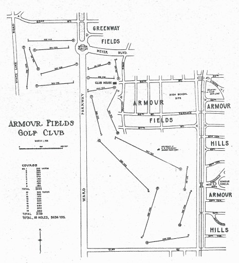
Temporary Armour Fields public golf course, 1926 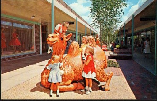
Camel sculpture in The Landing shopping center, early 1960s
Waldo Area
Gregory Boulevard to 85th Street; State Line to Troost Avenue

Country Club Dairy Ice Cream Stand inside Kiddieland at 85th & Wornall Road, early 1960s 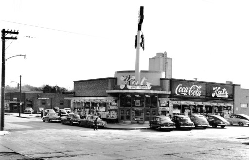
Katz Drug Store, southeast corner of 7thand Wornall, 1940s. 
Christ the King Church, southwest corner of 85th and Wornall Road, 1941. 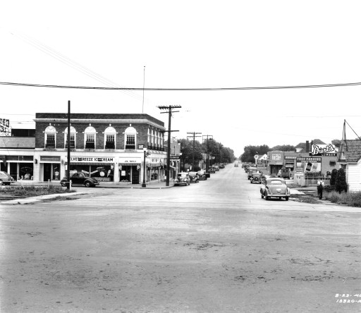
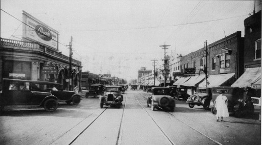
75th Street looking east, at intersection with Wornall Road. Circa 1930s. 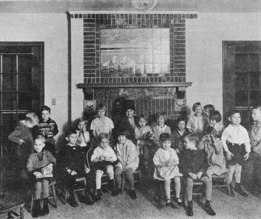
Mrs. Ella Loose (center back) visiting with Gillis home children on annual “Loose Shoe” Day. 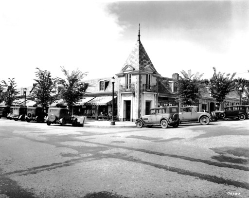
Romanelli Shops, southwest corner Gregory Blvd and Wornall Road, 1931. 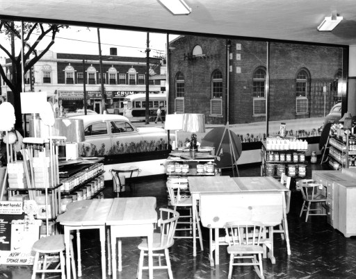
Interior of Colormax paint store, looking east across Wornall to streetcar station. 
Wornall Road facing north from 75th Street, circa late 1950s
Downtown / Midtown
Missouri River to Brush Creek, Troost Avenue to State Line


Lovely collection! However, Waldo photo #8 is clearly looking north, not south
LikeLike
Clearly it is! Thanks for the catch, and thanks for stopping by.
LikeLike